vincedchart
vincedchart

How to remove it? using * leaflet.motion - v0.3.2 (https://github.com/Igor-Vladyka/leaflet.motion#readme) ``` var dataCoords = []; function doMotion() { var seqGroup = L.motion.seq([ L.motion.polyline(dataCoords, { color: "MediumVioletRed", weight: 10, opacity: 0.8...
This is my call to L.Geoserver and I have an issue, with two different messages on Chrome and Geoserver I'm using Leaflet.motion as well ``` var dataCoords = []; function...
Hi, I would like to fix my Leaflet draw to draw lines with touch, where can I write this line ? Is it possible to add it in https://mappingforyou.eu/javascript/leaflet.draw-src.js and...
Hi. This plugin is very cool but I can still see the special fullscreen plugin I use in printing, it's not hidden as it should. I give you all info...
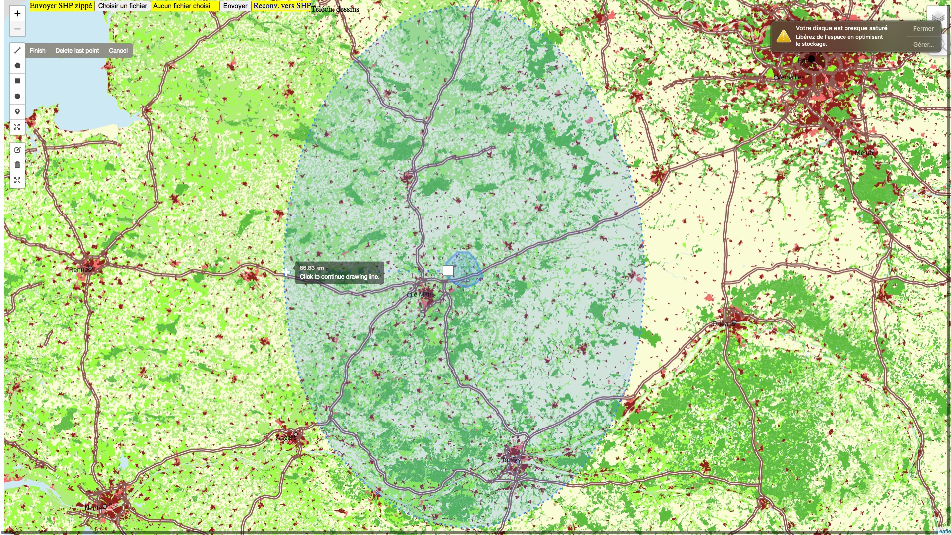 For a 100 km buffer around a polygon shape, the east-center and west-center is of 66,6 km , thats a 2/3 ratio, not...
Please help me hardcode variable category=35 by default using !isset I need to hide all categories by default besides category 35. here an example url point to category familie https://nissennetz.de/galerie/osmmap.php?/category/familie&v=2...
Hello, I'd like to pass this very interesting script to plain HTML, Javascript, to use it outside Piwigo to link my map mappingforyou.eu/france to my piwigo gallery. how should I...
I learnt Leaflet since two years, for my own, and Javascript at the same time, and I spend this time thinking too: how I could use Leaflet as a true...
This is nice, do you support Wms? i will then make my own colored heights and put it to geoserver... what color scheme should i respect?
Stamen tiles being now unaccessible, no map shows up with this yet GREAT plugin. for it to work again, everyone has to update code at least in files: - leaflet-providers.js...