krticka
![]()
krticka
Yes, you are right, for 202 Cliff caps should be rounded for better distinction between footpath and cliffs. There is an easy fix for this, see the picture. 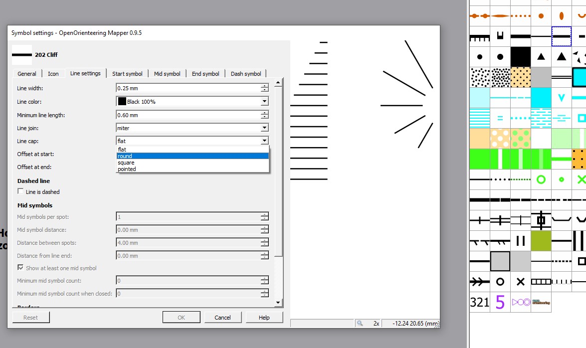 For...
Specification does not says about offsets, it is developers task to define map symbols. But your note is correct at least for line variant, automatic legibility checks will then work...
This issue is also connected with graphic area objects. For example I received Ocad file with map and separate file with design, where some texts were converted to graphics to...
It will be not official part of ISSOM. It will be published separately as recommended use for school maps. We don't want to make any clash with the existing school...
For old sprint specification I think it is good to keep valid name ISSOM 2007. ---------- Původní e-mail ---------- Od: app4soft Komu: OpenOrienteering/mapper Datum: 18. 4. 2019 19:24:21 Předmět: Re:...
In case of slivers the **Snap geometries to layer** tool in QGIS will do the trick.   
Virtual gap - duplicate of #150
Yes, I remember very well. We published [new document](https://orienteering.sport/iof/mapping/) few weeks ago regarding colors. Personally I am not completely satisfied with this document, still some problematic parts remain. Solution can...
The big buildings (more than 75*75 m) were always 60% black with 100% black outline. For smaller normal black buildings I can imagine very easily to have them above lower...
@eolmapper Everything is changing. Disciplines, rules and also maps. We are publishing corrections and new specifications or symbols if needed. You can expect new ISMTBOM and also new symbol to...