hanyangliu1002
hanyangliu1002
I need to correct the X axis to west longitude (0W to 180W) and east longitude (0E to 180E) instead of 0 to 360 degrees, or is the longitude in...
I have corrected it. Some areas are consistent with the coastline I added, while others are not. 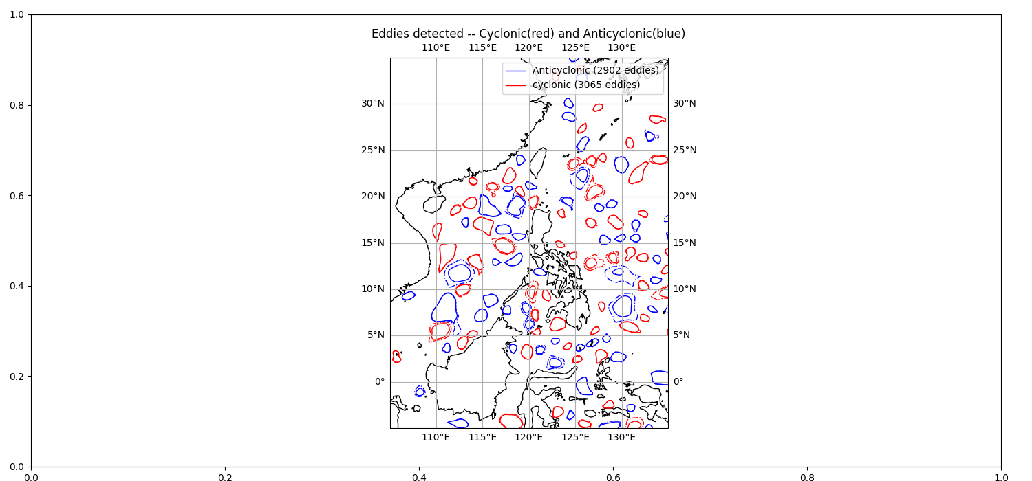
@NTUBobWu send me Email : [email protected] , chinese is ok.
Hi @dgwyther , I'm a master student in Taiwan : ) I'm curious how you calculated u and v and added these two parameters to the nc file. I recently...
I provide my code for you to check. The error finally shows is as follows (Using unregulargidDataset). - Traceback (most recent call last): File "x:\MasterStudent_HY\Some data\Simulated SWOT data\Step1_identification.py", line 24,...
the data information is as following : [The simulated SWOT data information.txt](https://github.com/AntSimi/py-eddy-tracker/files/9651325/The.simulated.SWOT.data.information.txt)
If I calculate the u and v parameters and put them in the original altimetry file(nc file), will I be able to do the eddy identification.
Dear @AntSimi I recently calculated the two geostrophic velocity components of u and v, and saved them to the nc file. The program seems to be able to work, but...
Dear @AntSimi data as following : [SWOT_L2_LR_SSH_Expert_266_008_20150101T003140_20150101T012245_DG10_01.nc.zip](https://github.com/AntSimi/py-eddy-tracker/files/10012846/SWOT_L2_LR_SSH_Expert_266_008_20150101T003140_20150101T012245_DG10_01.nc.zip) and code : ```python grid_name, lon_name, lat_name = ( "X:\MasterStudent_HY\Some data\Simulated SWOT data\SWOT_L2_LR_SSH_Expert_266_008_20150101T003140_20150101T012245_DG10_01.nc", "longitude", "latitude", ) from datetime import datetime from py_eddy_tracker.dataset.grid import...
The matrix size of ugosa and vgosa I calculated should be the same as the size of ssha_karin. I would like to ask how to solve the problem of dimension