d1g

Hello Mapbox(ers)! There a number of concerns why I'm suggesting this: - josm wiki is integrated within JOSM editor (this is what user(s) see when they are offline) - every...
Геокодирование по паре сотен POI внутри дома может выглядеть как overkill но для неё есть самое прямое применение в [OpenLevelUp](https://framagit.org/PanierAvide/OpenLevelUp). Главное чтобы osmid в ответе приходил. ##### Параметры API В...
Раз в OSM не обозначается old_name, alt_name, то хоть при геокодинге должно учитываться: http://www.openstreetmap.org/relation/337422 - Питер - Петербург - СПб - etc https://www.wikidata.org/wiki/Q656
Case 1: way tagged as amenity=kindergarten contains (way/multipolygon) building=school Expected result: osmose should warn about conflicting tags Case 2: way without amenty= tag but part of multipolygon with amenity=kindergarten contains...
Currently [Russian translation is ready via Transiflex](https://www.transifex.com/josm-scripting-plugin-docs/) but [in order to view it at site](http://gubaer.github.io/josm-scripting-plugin/) you have to include some code before /head> at every page: more info: - http://docs.transifex.com/live/getting-started/#add-the-javascript-code-in-your-webpages...
Thanks for the effort! But IMO count_highway_lenght_per_each_admin_level_4.sql plus count_highway_lenght_per_each_admin_level_4.md (copy&paste it from http://www.openstreetmap.org/user/baditaflorin/diary/38454) would be more easier to study for readers and for you to write and update. PS. [QGIS...
Rendering and details present at wiki: [natural=earth_bank](http://wiki.openstreetmap.org/wiki/Tag:natural%3Dearth_bank) 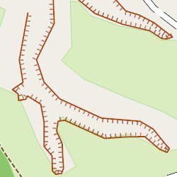 Some rationale "why another alias to cliff?" below natural=cliff was defined at wiki with close relation to natural rocks, but natural=cliff was...