[request] MR Challenge BBOX for GEOJson Input
It would be VERY cool to be able to specify a bounding box when creating a challenge that points to a geoJson file online.
We like to produce geojson files that have LOT's of rows in them and instead of having to generate different GEOJson files for each area, it would be so cool if there was an option in the challenge creation that would allow the challenge to be bounded by a bounding box or WKT that was specified. Then the generated challenge would only contain a subset of the rows from the GEOJson file. This would allow us to create multiple challenges from a single GEOJson file and each challenge would be a different area.
For instance, let's say I give you a link to a big GEOJson file: https://daylight-map-distribution.s3.us-west-1.amazonaws.com/mr/atlas_checks/USA_LoneBuildingNodeCheck.json
And then I'd like to create a Challenge that points to that remote URL for input. BUT I want to specify a bounding box That includes just the area around Portsmouth New Hampshire. So I give it a WKT like this:
POLYGON((-70.83320006846051 43.102047963449316,-70.78513488291364 43.12836296408742,-70.73088988779645 43.068699385233934,-70.7058273267613 43.02956062541329,-70.74530944346051 42.99115027663405,-70.8211837720738 43.00897767392595,-70.85757598398786 43.04436604163545,-70.84178313730817 43.06518795251524,-70.85173949717145 43.09327378195965,-70.83320006846051 43.102047963449316))
or a bounding box like this:
POLYGON((-70.85757598398786 43.111071524153296,-70.69346770762067 43.111071524153296,-70.69346770762067 43.01073502451472,-70.85757598398786 43.01073502451472,-70.85757598398786 43.111071524153296))
And Map roulette would open the GEOJson URL and start reading each row but it would completely skip anything that was outside of the given bounding box.
I could imaging that this would be a checkbox right under the GEOJson URL that would enable the bounding box and give the user a field to paste the WKT into, or a field like the Location priority rule that gives the user the ability to paste in the bounding box or a map button to be able to draw it.
Extending this idea, you could attach a GeoJSON to a new Challenge with multiple polygons in it, and create separate challenges for each polygon, each challenge containing the tasks that are within its polygon.
This would also require a property in that GeoJSON to uniquely name each Challenge, or act as a suffix to attach to the name.
Here's an example large challenge
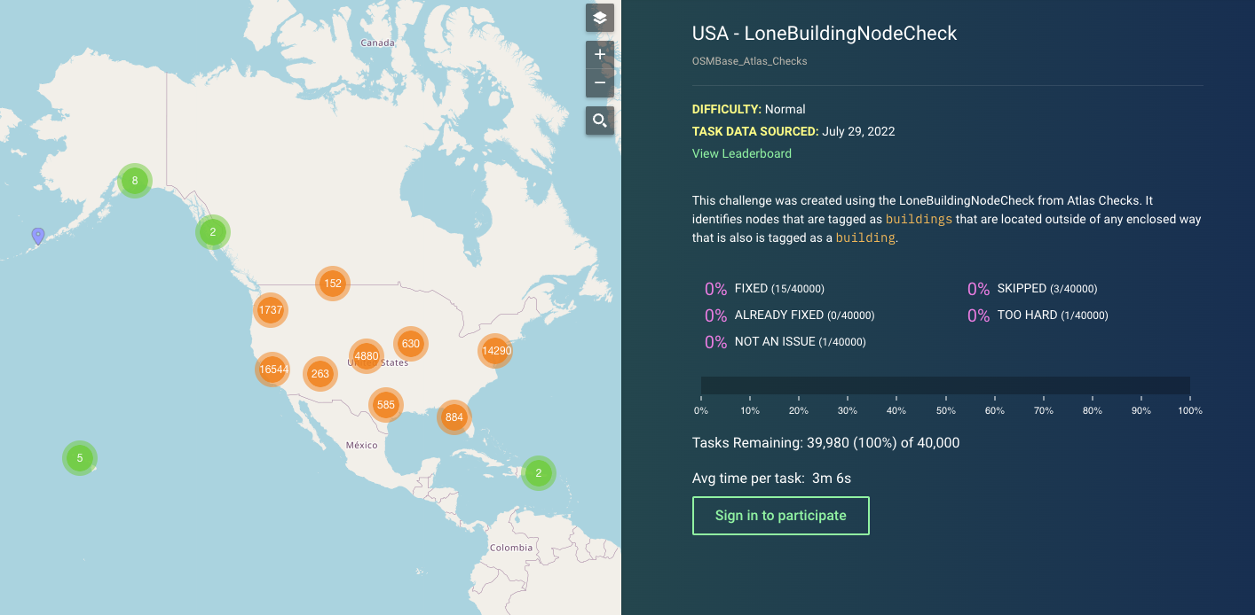
https://maproulette.org/browse/challenges/28410
This would be a good candidate for this feature. The Challenge creator would upload two items:
- the GeoJSON with the tasks themselves
- A GeoJSON with for example US state boundaries
In this case, 50 challenges (the number of states in the US, ignoring territories and PR for the moment) would be created.
Additional thoughts:
- When MapRoulette detects a large number of tasks being uploaded, it could even suggest to the user to subdivide them into smaller challenges.
- Should this (offer to) create a new Project to group these challenges together?
- Should the end user / mapper somehow be exposed to the fact that there are multiple challenges that are basically the same, but split by geography? For example by offering to work randomly across all the challenges.
For an MVP we could let the user draw an area of interest on geojson.io and copy or upload that to MR.