GEMPAK maps for metpy Mondays
can you please do video tutorials on displaying gempak maps in cartopy maybe even animated projections
Reference
I'm not sure what you mean by "displaying GEMPAK maps" in CartoPy. GEMPAK can save image files, but they're not geo-referenced in any way that can make them suitable for plotting with data. We can work to add the features to MetPy (and elsewhere) necessary to make it possible to reproduce GEMPAK plots using Python tools.
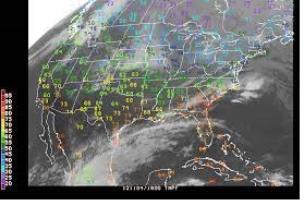
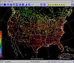
Adding colorization of text like the first and last image is an open issue that we can't do yet. #706
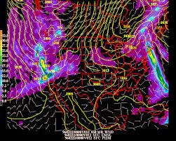
It's unclear to me what the second image does that's lacking in our existing gallery of python-training examples.
I'm not sure there's anything actionable here. The colormapping text temperature is already covered by #706, and we have examples of pretty much everything above. Feel free to re-open if there's a specific request for a GEMPAK-plot that we don't have an example of but should.